18th EFAS Annual Meeting
The 18th EFAS Annual Meeting was held as a hybrid meeting on 28-29 September 2023. The meeting was organized by the Joint Research Centre (JRC) with the support of all CEMS Flood centres, and hosted at the Germany’s National Meteorological Service (DWD) in Offenbach Am Main (Germany). 70 participants from the EFAS partners/third parties, and operational centres joined the meeting in person, 35 followed online.
EFAS Annual Meetings have the purpose to bring together the community of EFAS partners/third parties and service providers to communicate and discuss evolutions to the systems, issues and opportunities for improvement. The 18th EFAS Annual Meeting included plenary sessions with presentations by EFAS service providers and EFAS partners/third parties, workshops for detailed discussions about technical topics, and a novel market place activity to engage in lively conversations about several aspects of the EFAS service.
This page provides a summary of the meeting; all the presentations and posters are available for download at the bottom of the page.

Participants of the 18th EFAS Annual Meeting hosted at the DWD (Offenbach am Main, Germany)
Summary of the meeting
The 18th EFAS Annual Meeting was chaired by Peter Salamon (EC JRC, coordinator of the Copernicus Emergency Service European Flood Awareness System - CEMS EFAS). The opening ceremony included the welcome messages by Christina Koppe (DWD), Attilio Gambardella (DG DEFIS), Olimpia Imperiali (DG ECHO).
Status of EFAS operational – experiences, issues, challenges
The first plenary session of the 18th EFAS Annual Meeting (Day 1) included a presentation from each one of the five CEMS Flood centres. Each CEMS centre briefly explained their role, introduced the team, and communicated the major achievements, issues, and challenges since the 17th EFAS AM (27-28 September 2022).
CEMS Meteorological Data Collection Centre (MDCC)
The Copernicus Emergency Management Service Meteorological Data Collection Centre (CEMS MDCC) introduced the team and provided an overview of their activities. CEMS MDCC collects, quality-controls and post-processes in situ and ground-based remote sensed meteorological data. Quality controlled and post-processed meteorological data are then used by CEMS MDCC to generate gridded spatial information required as input by the hydrological model used within EFAS (Open Source LISFLOOD). Observations for the 7 parameters used by the hydrological model are delivered to CEMS MDCC by 32 data providers. Over 22000 stations provide observations in real time, while over 33000 stations provide historical observations. Using these data CEMS MDCC generated daily and 6-hourly grids for the EFAS domain, these grids include the following meteorological variables: precipitation, max/min/average air temperature, vapor pressure, wind speed, solar radiation. Furthermore, CEMS-MDC computes the Standardized Precipitation Index (SPI) based on ERA5 reanalysis for the global domain; the Heat and Cold Wave Indicator (HCWI) based on ERA5 reanalysis for the global domain. The most important ongoing development features the improvement of the data validation protocol, which was presented in detail during the session “Upcoming and ongoing developments in EFAS” (Day 2). Furthermore, CEMS MDCC constantly strives to further expand the stations network: the presentation provided detailed information about data licence: data is used in accordance with the license agreement between the European Environment Agency (EEA) and EUMETNET, or an equivalent licence. CEMS MDCC writes annual reports to summarize data collection and quality control activities.
CEMS Hydrological Data Collection Centre (HDCC)
The Copernicus Emergency Management Service Hydrological Data Collection Centre (CEMS HDCC) introduced the team and provided an overview of their activities. CEMS HDCC collects, quality-controls and post-processes (temporal aggregation) in situ hydrological data since 2012. Until 2022, CEMS HDCC collected only river water level and discharge observations, both near real time and historical data. In 2023, CEMS HDCC started collecting reservoir-related variables, this new activity was explained into detail in the section “Upcoming and ongoing developments in EFAS” (Day 2). CEMS HDCC works in close collaboration with the data providers in order to identify erroneous observations, and solve problems with the data transfer. Visits at the data providers premises can be organized to clarify aspects of the data collection and investigate optimal solutions for data transfer. The number of hydrological data providers steadily increased over the years. In 2022, CEMS HDCC collected data from 70 data providers from 41 countries; 52 data providers deliver data in near-real time. Thanks to the contribution of the data providers, CEMS HDCC database includes observations for 54% of all the European water basins. The total number of stations is 4305, of which 2048 provide data in near real time (1985 only discharge, 1887 only water level, 1460 both discharge and water level). 305 new stations, from 6 different data providers, were inserted into the CEMS HDCC database since the 17th EFAS Annual Meeting. CEMS HDCC strives to constantly improve the data validation protocol. Each observation is subject to 7 different and complementary quality checks (e.g. range control, variation vs previous value, etc..). Only raw observations that pass the 7 initial checks are used for temporal aggregation in order to produce the operational values. Since 2022, a quality summary flag is associated to each operational value. Hydrological observations are used within EFAS for the calibration of the hydrological model, calibration and delivery of post processed forecasts, for the National Flood Monitoring Layer: this page explains how hydrological data are used within EFAS. CEMS HDCC writes annual reports to summarize data collection and quality control activities, moreover, these reports include the analysis of the hydrological conditions in Europe. The 2022 annual report (which will be openly available in the next few months) showed that the water volume in the rivers in 2022 was smaller than the water volume of the historical reference period 1991–2019.
CEMS Hydrological Forecast Centre – Computation (COMP)
The Copernicus Emergency Management Service Hydrological Forecast Centre – Computation (COMP) introduced their team and gave an overview on their activities. CEMS COMP is responsible for 24/7 EFAS operations in terms of computations, data delivery, visualization via the web-services, and data archiving. Furthermore, CEMS COMP contributes to the continuous development and evolution of products and web-services. Relevant EFAS model and system upgrades were implemented operationally since the 17th EFAS AM. More specifically, EFAS v4.6 implemented enhanced Rapid Risk Assessment information tables; EFAS v4.7 included the products of the CEM Global Flood Monitoring in the EFAS IS; EFAS v4.8 embedded a new weather prediction cycle (48r1); EFAS v5.0 delivered major upgrades to several components of the system. EFAS v5.0 major upgrade was discussed during the dedicated session “All you need to know about EFAS v5.0” (Day 1). From a technical point of view, the web-service migration to Bologna (announced during the 17th EFAS AM) was successfully completed in November 2022 with minimal impact. CEMS COMP furthermore informed the audience about five minor incidents that occurred in the last year (e.g. web-delivery delays): the impacts of these incidents was promptly minimized, and a continuous review of the protocols is in place to further improve the service. The presentation concluded with an overview of the collaborations and interactions with the other CEMS centres. CEMS COMP collaborates with all CEMS Flood centres since they are located in the middle of the chain between data collection and analysis (CEMS MDCC, CEMS HDCC, CEMS GFM), forecast analysis and dissemination (CEMS DISS).
CEMS Hydrological Forecast Centre - Analytics and Dissemination (CEMS DISS)
The Copernicus Emergency Management Service Hydrological Forecast Centre - Analytics and Dissemination (DISS) provides analysis of the system and issues EFAS notifications of riverine and flash flood events. Furthermore, CEMS DISS supports EFAS partners/third parties by providing trainings, webinars, online documentation (e.g. EFAS User Guide). Finally, CEMS DISS conducts analyses of the EFAS service through the collection of feedback from the EFAS partners/third parties and through dedicated internal studies. Therefore, for CEMS DISS it is of paramount importance to: 1) know the needs of the EFAS partners/third parties; 2) understand how the existing EFAS information and products are used and what is missing; 3) collect partners/third parties’ feedback to improve EFAS service.
CEMS DISS constantly strives to optimize the communication and exchanges with the EFAS partners/third parties network, which has been consistently growing since 2013. As of September 2023, the EFAS network is composed by 80 EFAS full partners (1 new since the 17th EFAS AM), 64 EFAS third party partners (6 new since the 17th EFAS AM), 1 research partner.
In the period from January till August 2023, CEMS DISS issued to the relevant EFAS partners/third parties 158 Formal Flood Notifications (137 in 2022, from January to December), 156 Informal Flood Notifications (175 in 2022), and 1169 Flash Flood notifications (772 in 2022).
CEMS DISS collects and analyses the feedback for each notification in order to assess their accuracy and usefulness. Understanding the usefulness of EFAS notifications is crucial to improve the system. Furthermore, EFAS partners/third parties are encouraged to notify events which were missed by the EFAS forecasts. A detailed presentation of the missed event reports and of the feedback received in 2022 was provided during the session “Upcoming and ongoing developments in EFAS” (Day 2). The full report about the feedback received in 2022 is available in this page of the EFAS web site.
CEMS DISS completed 14 pre-tasking of satellite images acquisitions since the previous EFAS AM. Pre-tasking of satellite images has the purpose to coordinate the acquisition of timely satellite imagery of the areas potentially (according to EFAS forecasts) affected by significant flooding.
Every year, the CEMS DISS performs a detailed assessment report of EFAS forecasts and system performance (including the issue of notifications) for one relevant flood event. The detailed assessment report for the year 2022 focused on the floods in September and November 2022 in South-Central Italy, on the West Coast of the Apennines. The detailed assessment reports are published in this page of the EFAS web site. The 2022 will be available by the end of 2023.
All the partners/third parties are invited to provide their opinion about EFAS service (EFAS forecasts, EFAS products and data, EFAS online documentation, webinars, reports, trainings) via the annual surveys. The results of the annual surveys are analysed and published in the EFAS web page, the results of the EFAS Partner Survey 2022 are available here. All EFAS Partners/third parties will be invited to provide their feedback for the year 2023 in January 2024 (check your email box for messages from CEMS DISS!).
The EFAS partners/third parties were reminded that they can request a dedicate onsite training. These trainings were held in 2022: EFAS Training for the International Meuse Commission | Copernicus EMS - European Flood Awareness System, EFAS trainings for the partners in Georgia and Denmark | Copernicus EMS - European Flood Awareness System).
Finally, all EFAS partners/third parties were reminded to carefully verify their contact information: administrative contact, technical contact, and other contacts during events. EFAS partners/third parties can send an email to efas@info.eu for questions and updates.
CEMS Global Flood Monitoring (CEMS GFM)
The Copernicus Emergency Management Service Global Flood Monitoring (CEMS GFM) introduced the team and explained their service. CEMS GFM provides continuous monitoring of floods worldwide by immediately processing and analysing all incoming Copernicus Programme Sentinel-1 Synthetic Aperture Radar (SAR) satellite data. SAR satellite data enable flood detection at day and night, regardless of the weather conditions. CEMS GFM products are computed through the application of three flood detection algorithms. Being a fully automated system, one of the strengths of CEMS GFM products is the high timeliness.
CEMS GFM product output layers include Sentinel-1 observed flood extent, reference water mask, and observed water extent. Other product output layers provide relevant contextual information. Examples are: the exclusion masks to identify areas where Sentinel-1 derived flood delineation is hampered; likelihood values accounting for classification confidence; advisory flags indicating challenging classification circumstances
The presentation then showed an example of application: flood inundation extent monitoring during the September 2022 floods in Pakistan. The last part of the presentation explained the product versioning method to track major, minor, and patch updates to the system.
UCPM operations for floods: EFAS through the eyes of ERCC
The second plenary session of the meeting (Day 1) featured a presentation by DG ECHO.
The Emergency Response Coordination Centre (ERCC) of of DG ECHO (European Civil Protection and Humanitarian Aid Operations) was launched in May 2013. The ERCC has the purpose to improve the coordination between civil protection and humanitarian aid operations. Furthermore, it maintains a direct link to civil protection authorities and humanitarian aid organisations in EU Member States enabling real-time exchange of information. The ERCC monitors disasters around the globe; maps disaster risks; provides real-time information; coordinates joint European response operations.
When an emergency overwhelms the national response capacities, the EU Civil Protection Mechanism (UCPM) fo eht fo enables a coordinated assistance by all EU Member States and 10 Participating States.
, under the coordination of the ERCC, enables the provision of assistance by all EU Member States and 10 Participating States.The presentation then explained the workflow of the EU Civil Protection Mechanism. The UCPM is activated when the affected country issues a request for assistance through the ERCC. The trigger of the request can be a natural or man-made disaster, inside or outside of EU. The ERCC then coordinates the deployment and delivery of assistance (personnel and equipment). The assistance is offered by EU Member States and participating states. The ERCC may also deploy a team of EU Civil Protection experts. The ERCC Situational Awareness Team leverages on the scientific advisory mechanism (input) to deliver strategic anticipation/operational preparedness/emergency advice (output). The ERCC coordinates the operations until the end of the emergency response.
The presentation then provided details about the UCPM response to the floods in Slovenia in August 2023: countries that offered equipment and delivery of assistance. Greece did not activate the UCPM during the floods in September 2023. Nevertheless, seven satellite maps delineating the flood extent have been delivered to Greece following the activation of the Copernicus Emergency Management Service. The ERCC coordinated the monitoring and forecasting of the event starting from 4 September 2023 leveraging on ARISTOTLE (All Risk Integrated System TOwards Trans-boundary hoListic Early-warning) monitoring reports, these reports made use of EFAS flood forecasts.
The presentation concluded by highlighting the ERCC informative role via the ECHO Daily Maps and ECHO Daily Flash.
Everything you need to know about EFAS version 5.0
The third plenary session of the 18th EFAS AM (Day 1) was entirely dedicated to the very recent major operational upgrade of EFAS: EFAS v5.0 was released on September 20th, 2023. The session explained the relevant changes to the system and their expected positive impacts on EFAS performances.
EFAS v5.0 introduces several major changes to the system, including:
A higher spatial resolution. EFAS v5.0 has a 1 arcmin / 0.0167 degrees resolution (~1.4km), as opposed to the 5-km resolution of all the previous EFAS versions.
A different projection system, now based on EPSG:4326 instead of ETRS89 Lambert Azimuthal Equal Area Coordinate Reference System (ETRS-LAEA) for previous versions.
A larger modelling domain whose extension has been enlarged to match the river catchments.
Major improvements to the open-source hydrological model LISFLOOD.
An entirely new set of 0.0167 degrees resolution input maps produced using the most recent research findings, remote sensing, and in-situ datasets. The EFAS v5.0 0.0167 degrees resolution static maps are available for download from the JRC Data Catalogue, the complete documentation is available from the OS LISFLOOD User Guide.
A new calibration at 1903 in-situ gauging stations. Furthermore, a parameter regionalisation was performed to estimate the parameters of catchments for which in situ discharge observations were not available. The model performance layer on EFAS-IS shows LISFLOOD performance (KGE’) at the calibration stations.
New reforecast configuration (medium-range),with the hydrological reforecast being generated during the operational processing chain, ensemble headline forecast skill scores updated each quarter EFAS medium-range forecast skill - Copernicus Emergency Management Service - CEMS - ECMWF Confluence Wiki
The EFAS v5.0 river discharge reanalysis (1992 to near real time) is available from the C3S Climate Data Store. Snow depth water equivalent and volumetric soil moisture will be available in the next few months.
The EFAS v5.0 medium range forecasts are available from the C3S Climate Data Store after the 30 days embargo. Medium range and seasonal reforecasts will be made available in the next months.
New return period thresholds and snow water/soil moisture anomaly maps based on the 1992-2022 climatology.
Reporting points: flood probability is computed for grid cells with area larger than 50 km2. Minimum upstream area to be a reporting point, fixed or dynamic, decreased to 150 km2 (before 500 km2). EFAS v5.0 has 3070 fixed reporting points. “Tiny” reporting points (upon request of the partners/third parties) are an exception: they are 269 and they have upstream area between 50 and 150 km2.
Post processing at 1580 reporting points. New post-processing calibration; revamped pop-up window showing providers’ thresholds (discharge only) and more comprehensive metadata (more details were provided by the booth “EFAS Post Processing”).
EFAS Flash floods: ERIC product is now computed from simulated LISFLOOD surface runoff output (previously computed using a regression to translate precipitation and soil moisture into surface runoff). ERIC notification points and reporting points shown only for catchments below 1000 km2.
Rapid flood mapping layer based on new flood hazard maps generated using LISFLOOD-FP at 90m (previously 100m) resolution and flow forcings from EFAS v5.0 reanalysis.
Revamped Rapid Risk Assessment layer making use of updated exposure information.
Updated EFAS Seasonal and Sub-seasonal forecasts using the newly calibrated, higher resolution hydrological model.
The presentation concluded by showing the example of the EFAS rapid flood mapping layer with 2 days lead time for the flood event in early September 2023 in Greece.
EFAS Partners/third parties contributions
The fourth plenary session of the 18th EFAS AM (Day 1) was dedicated to the contributions from the EFAS partners/third parties. EFAS partners/third parties were invited to share their experience with EFAS and/or developments within their institutions in the format of oral presentations or posters. The first call for contributions was sent in March 2023 (collection of expression of interest to participate to the 18th EFAS AM), and then reiterated in July and August. Eight EFAS partners/third parties responded to the call. The short summaries below were provided by the presenters. For each contribution, the full list of authors can be found in the presentation or poster.
A Microsoft Teams site devoted to exchange of information during a flood situation, by Michael Antoine, Bruxelles Environnement (Belgium)
Based on the technology available in Microsoft TEAMS, the various Brussels water operators (river manager, waterway manager, sewer and wastewater treatment plant manager) have developed a TEAMS site containing all useful information: procedures, checklists, up-to-date emergency contacts, logbooks, crisis scenarios with associated flood maps, but also virtual meeting rooms and websites incorporated within of the interface (EFAS, telemetry network, flood website for neighboring regions, etc.). The objective is for all the information to be easily accessible and brought together in a functional website that can be quickly implemented without additional costs.
Integration of EFAS forecasts into the flood forecasting system of Brandenburg/Germany by Maik Renner, LfU Brandenburg, Hochwassermeldezentrale (Germany)
Flood warning and forecasting for the federal state of Brandenburg are provided by the Landesamt für Umwelt / Hochwassermeldezentrale. For flood forecasting of the Oder River we currently provide forecasts with a lead time of two days. In order to extend the forecast range we are aiming to include EFAS medium range flow forecast products into our forecasting system. The current system uses the Delft-FEWS software for data and model management, which links input data of measurements and external forecasts to operate a hydrodynamic model of the German section of the river. In order to employ EFAS data in our system we choose the Sensor Observation Service (SOS) which is an OGC compliant web-service provided by EFAS. Therefore, a new version (EFAS SOS 2.0) of the Delft-FEWS adapter was developed and is now accessible for all other FEWS users. With this adapter, EFAS forecasts of selected river gauges can be imported into FEWS as a direct comparison to other forecasts and as model input to existing models such as the hydrodynamic model. We assessed the EFAS forecasts during a period of higher flow conditions in October 2020 and under current condition. Although EFAS provides ensemble forecasts, these are not error corrected with observations and show large offsets, which is not useful for model input. We also evaluate the post processed quantile forecast product as an alternative to the ensemble forecasts. As third option we suggest that model simulation data should be provided by the EFAS SOS service to allow EFAS partners/third parties to perform ensemble forecast post-processing with their observational data and methods. We conclude that integration of data products by EFAS into local flood forecasting systems is a very useful means to assess the hydrological situation and its inherent uncertainty for up to 10 days at larger river basins.
From hydrological to impact based forecasts by Tali Horowitz, Israeli Water Authority (Israel)
Flood forecast is given first and foremost to help civil protection agencies to prepare before and during flood events. The vulnerability of each area would determine much of the actions and preparations that should be taken. Together with local drainage authorities and historical impact data, we work to translate hydrological forecasts (mapping the expected probability and intensity of flow) to risk levels for four different warning types: Travel routes, Roads, River bank overflow and Pluvial flooding. Using these highlights civil protection agencies can focus their efforts in time and space to reduce damage for human life and property. The presentation demonstrates our website and methods on how to convert flood forecasts into 6h risk maps. We work with our clients to increase clarity on where, how many, when, and what kind of risks can be expected so that they can prepare the manpower and the tools. The website is currently at the final stages of development for its first version.
Devastating floods in Thessaly, Greece 4-7 September 2023 by Artemis Papapetrou, Hellenic National Meteorological Service (Greece)
The presentation provided the analysis of the flood event: meteorological forecasts, EFAS notifications, meteorological in situ observations, remote-sensing derived flood inundation maps, impacts.
Probabilistic 6-week-forecasts for the German waterways by Germany, BfG: Bastian Klein, Dennis Meißner
Since July 2022, the German Federal Institute of Hydrology is providing an operational 6-week forecasts for selected gauges at the major waterways Rhine and Elbe. Recently a wavelet-based output correction and the postprocessing method EMOS have been implemented into the forecasting workflow to further increase the predictive skill. Analyses based on hindcast experiments show significant improvements between raw and postprocessed forecasts as well as differences depending on the selected catchment and forecast season. Given the increasing uncertainties related to longer lead times, proper postprocessing and user-oriented communication are key elements in providing skill- and useful long-term forecast.
Flood-events in Austria: August 3-7th and 27-29th 2023 by Petra Lalk (see the full list of authors in attachment), Austria Federal Ministry of Agriculture, Forestry, Regions and Water Management
The poster provided the analysis of the flood events in August 2023: meteorological situation, EFAS forecasts and notifications, hydrological analysis of the event including the assessment of drivers and return periods.
Annual report on the flood events for 2022 in Bulgaria by Georgy Koshinchanov (see the full list of authors in attachment). Bulgaria National Institute of Meteorology and Hydrology
The poster provided an overview of the EFAS notifications received by the Bulgaria National Institute of Meteorology and Hydrology in 2022; the list of hits, false alarms, and missed alerts; and an in-depth analysis of 3 flood events.
MeinePegel.App by Germany by Natalie Stahl-VanRooijen, LfU Bayern
MeinePegel.App is a join initiative of the German federal states with the purpose to provide a common portal of the flood forecast centres. The app provides forecasts, actual water levels, flood information, individual push information.
Facilitating EFAS communication – modification of the EFAS conditions of access
The fifth plenary session (Day 1) was led by Peter Salamon and it had the purpose to discuss ways to improve communications about EFAS, especially in occasion of media requests in the aftermath of flood events.
Firstly, Peter Salamon announced the publication of a Frequently Asked Questions page in the EFAS web site: Frequently Asked Questions (FAQ) | Copernicus EMS - European Flood Awareness System (efas.eu). This page lists a collection of more than 20 questions raised by media about EFAS. The pre-compiled answers can be used by EFAS partners/third parties in case they are recipients of media requests. There often is a high media echo during and in the aftermath of flood events, the EFAS FAQ page has the purpose to support the EFAS partners/third parties and to facilitate communication about the performance and limitations of EFAS. Furthermore, the pre-compiled answers of this page aim to help explain why EFAS real time forecast data are restricted and not publicly available (single voice principle). This page will be continuously updated to provide the best possible support to EFAS partners/third parties.
Secondly, Peter Salamon presented a summary of the ongoing conversation about revisions to the text of the EFAS Conditions of Access (CoA). The proposed revision concerns the coordination of communication about EFAS.
Peter Salamon provided a presentation to summarize the history and status of the discussion. In 2022, it was proposed to reduce the 30 days embargo for EFAS real-time forecasts to 15 days. This proposal was communicated via email in June 2022 and then discussed during the 17th EFAS AM. The minutes of the discussion during the 17th EFAS AM are available from this page (please note that this page can be accessed only by EFAS partners/third parties). The main conclusions of the 17th EFAS AM were: while the large majority of EFAS partners was in favour of the change, 6 EFAS partners raised concerns with regard to the proposed change. It was therefore agreed to further discuss the proposed change individually with the 6 EFAS partners in order to find an agreement that would take into account their concerns.
Based on the compromise which was agreed upon with the relevant 6 EFAS partners the new, proposed change of the EFAS CoA is highlighted in red in the table below.
| Existing EFAS CoA | Proposed changes |
EFAS real time forecast information is restricted with a 30 day embargo period. Initial conditions and seasonal forecasts are freely available; | None |
EFAS partners (not third parties) can decide to publish EFAS information for their region before the 30 day embargo period. | EFAS partners (not third parties) can decide to publish EFAS information for their region before the 30 day embargo period. The European Commission with the support of the EFAS centres may share EFAS products and data not older than one month for the general public in specific situations (e.g. communication requests) and in coordination with the relevant EFAS partner(s). |
During the EFAS AM, Peter Salamon presented the summary of the feedback about the proposal and provided some clarifications:
No negative opinion, some positive feedback.
Clarification on what “specific situations” are: intentionally not defined precisely to be able to respond to unforeseen specific situations. However, all requests in relation to these specific situations will be coordinated and agreed with the relevant EFAS partner(s)!
Clarification on “in coordination with the relevant EFAS partner(s)”: It is confirmed that this means that EFAS partners/third parties and JRC agree on the sharing of products for the specific situation and if there is no agreement nothing will be shared.
Remark on communication “in coordination with” after flood events as these are typically very busy periods for the EFAS partners/third parties: It should be noted that these situations are an exception/will not occur frequently and that the JRC aims to be as brief and concise as possible to avoid any major additional burden on EFAS partner side.
Peter Salamon then highlighted that questions from media usually come in the immediate aftermath of flood events, which is when the EFAS partners are very busy. In coordination with means that JRC will contact the relevant EFAS partner, but the JRC will try to minimize the burden on the EFAS partner.
After this summary, on-site and online EFAS partners were invited to share their questions and opinions.
Bayerisches Landesamt fur Unmwelt (LFU, Germany) requested a clarification about the temporal coverage of the communications. Specifically, they wanted to know whether the proposed change applied exclusively to communications with the media after the floods, or if the proposed change included communications during the flood events.
Peter Salamon clarified that the proposed change does not aim at the communication of real time forecasts and information. The purpose of the proposed change is to improve the coordination of communications about EFAS, in particular in the aftermath of an event. Under the existing conditions of access, any media request addressed to the EC JRC is immediately forwarded by EC JRC to the relevant EFAS partner. This situation is not ideal because it further increases the workload of the EFAS partners during critical times. With the proposed changes to the conditions of access, EC JRC can support the EFAS partner in responding to the media requests. These responses will not include real time information.
Attilio Gambardella (DG DEFIS) then raised a third scenario: media sources can directly approach the European Commission, and ask for information. In this scenario, the European Commission is legally obliged to respond in 2 weeks. This is a law and EC JRC or DG ECHO will have to comply. Of course, EC JRC and DG ECHO will consult the relevant EFAS partner, nevertheless, the law imposes to provide an answer in 2 weeks. European citizens have the right to request the access to public documents.
Peter Salamon then recalled that this scenario happened in 2021 (July floods in Central Europe). In that specific case, however, at the time of the issue of the request to the European Commission came, one of the EFAS partners had already published the EFAS notifications. Therefore, the European Commission forwarded the information that was already published by the EFAS partner. If this scenario repeats in the future, adequate coordination between EC JRC and the relevant EFAS partners will be crucial (unless, information has already been disclosed by the relevant EFAS partner, as in 2021).
No further comments were made by the participants. The proposed changes to the EFAS Conditions of Access were voted and approved by the EFAS partners present and online with no objection.
Ongoing and upcoming developments in EFAS
The sixth plenary session of the 18th EFAS AM (Day 2) included four presentations about ongoing and upcoming innovations to various aspects of the EFAS service. Two presentations focused on improvements to EFAS notifications: the optimization of notifications criteria for riverine flooding, and the collection of feedback on EFAS notification. Two presentations focused on in-situ data collection: the collection of reservoirs-related hydrological data, and the improvements to the validation protocol for meteorological data.
An assessment of the EFAS notifications criteria
This presentation discussed a review of the criteria for the issue of EFAS Formal notifications. EFAS Formal flood notifications are issued to the EFAS partners/third parties if a set of criteria is met: contributing area larger than 2000 km², lead time from 48 to 240 h, at least one deterministic model exceeds the discharge threshold (5-year return period), and at least one probabilistic model predicts 30% exceedance probability of that discharge threshold for three or more consecutive forecasts (persistence criterion). The detailed explanation of the criteria for the issue of EFAS notifications is available here. It must be considered that the operational EFAS is being regularly updated, consequently, the configuration of EFAS has changed since the time these notification criteria were defined (e.g. the temporal resolution has increased from daily to 6-hourly). A study was therefore conducted to assess the skill of the existing Formal notification criteria, and to derive a new set of Formal notifications criteria that optimizes the notification skill, that is the trade-off between hits, misses, and false alarms.
The study focused on 4 key questions: 1) How can we optimally combine the 4 numerical weather prediction models (ECMWF-Ensemble, COSMO, DWD-Det, ECMWF-Det) used within EFAS?; 2) Is the 30% probability threshold still optimal?; 3) Is the persistence criterion still useful?; 4) Can we reduce the minimum catchment area without compromising skill?
The study used fixed reporting points with a contributing area larger than 500 km² and a ‘KGE larger or equal than 0.5 (EFAS v4.0 calibration). Discharge observations and forecasts were both retrieved from EFAS v4 model set-up. Specifically, EFAS v4 discharge reanalysis data were used as proxy for observations; EFAS v4 reforecast data were the forecast data. The temporal extent of the study covered over 2.5 years: from October 2020 to June 2023. Flood events were identified when the EFAS v4 modelled discharge (reanalysis or reforecast) exceeded the 5-year return period (based on EFAS v4 climatology). The study aimed at identifying the set of criteria that allow to maximize both recall (ratio between hits and observed events) and precision (ratio between hits and predicted events).
The analysis showed that: 1) Probabilistic numerical weather predictions have higher skill than deterministic weather predictions. Therefore, the optimal way to combine the 4 numerical weather prediction models requires to weight the models based on skill. 2) The optimal probability threshold is ~ 50%. 3) Persistence is not necessary. 4) Notifications skill decreases with decreasing area, however, notifications have skill up to 1000 km2.
When implementing the new criteria explained above to the test data set (over 2.5 years, EFAS v4 set-up), recall increased by 4% while precision decreased by 2%. The study demonstrated that the proposed criteria allow an improvement of the notifications skill. The study was conducted using EFAS v4 data, it is envisaged to repeat the analysis using EFAS v5 data (as soon as a long enough time series is available).
The operational implementation of the revised criteria is planned in the next months. EFAS partners/third parties were invited to join a testing group to provide feedback prior to the operational implementation.
EFAS notifications in 2022, feedback collection: summary and awards!
The presentation started with highlighting the importance of providing feedback on EFAS notifications.
Feedback enables to: 1) monitor impacts of implemented changes to EFAS from a user perspective; 2) identify potential weaknesses of EFAS and assess the performance of the system; 3) shape future developments of EFAS.
While feedback on EFAS Formal notifications and Flash Flood notifications have been collected since 2016 and 2021 (respectively), the collection of feedback on EFAS Informal notifications started in 2022. Furthermore the protocol to send reminders to the partners/third parties (in case the feedback was not submiteed) is currently being automatized.
In 2022, feedback was provided for 30% EFAS Formal notifications, 5% EFAS informal notification, 19% EFAS Flah Flood notifications.
The full report is available from this EFAS page. The presentation provided an overview of the main conclusions.
Flood events were observed for 49% of the issued EFAS Formal/Informal Flood Notifications; compared to the last years feedback response, this result showed a small decrease of the number of false alarms and therefore an improvement.
The accuracy of EFAS Flood Notifications was then investigated for those 49% instances. Location: 55% of responders stated that the location of the event had been as indicated in EFAS information. Timing: 71% of responders stated that the flood peak was observed on the predicted day. Magnitude: 48% of responders stated that the peak magnitude was comparable to the EFAS prediction.
There was a high number of false alarms for Flash Flood Notifications, with 71% of the notifications not being observed in reality in 2022 (for reference, the percentage of false alarms was 61% in 2021).
The main drivers of flood events in 2022 were extreme rainfall events and long lasting rain events.
The audience was then reminded of the possibility to notify events which were missed by EFAS forecasts. Per year, three missed events are analysed by CEMS DISS to produce a short, standardized report. The purpose of the missed events report is to assess the reasons for the event being missed by EFAS and to outline suggestions for improvement. Starting from 2023, the reports on missed events will be shared with the partners/third parties who have notified the error in the EFAS forecasts.
Finally, as promised during the 17th EFAS AM, the presentation concluded with an award ceremony to celebrate the EFAS Partner that had the highest feedback rate in 2022. The 2023 EFAS feedback notifications award was won by the Hellenic National Meteorological Service, who had an impressive feedback rate of 90% for Formal/Informal notifications during 2022.
CEMS Hydrological data collection: reservoirs data
CEMS HDCC has been collecting river water level and discharge in situ observations, both near real time and historical data, since 2012. In 2023, CEMS HDCC started collecting reservoir-related variables. These variables are reservoirs inflow discharge, outflow discharge, storage volume, and water level. An email to all the EFAS data providers was sent in August 2023 in order to announce this development. The presentation then showed an example for data collection for 49 reservoirs in the Guadalquivir river basin. The CEMS HDCC is keen to expand the database in collaboration with the EFAS data providers. Furthermore, the CEMS HDCC will implement a quality control protocol also for reservoirs-related variables.
CEMS Meteorological data collection: new data validation framework
The CEMS MDCC checks incoming observation data using different quality checks, e.g. min/max validation (incoming values are checked against min/max thresholds), rate of change validation (rate of change between two sequential values against max variation thresholds). The resulting quality flags decide whether data are used to deliver the CEMS products (e.g. gridded meteorological maps for EFAS).
In 2022 the CEMS MDCC has worked to further improve the existing quality control protocols. The principles highlighted during the presentation were:
Use of different min/max threshold values for different climate zones and seasons, to account for different geographic, physiographic conditions and intra-annual variability.
Flat liner detection: check on consecutive equal values that exceed a plausible time period.
Introduction of spatial comparison checks: use measurements from neighboring stations to assess the quality of an each observation (e.g. spatial zero comparison to identify stations with zero
precipitation if neighbours show significant rain)
The presentation continued by providing examples of implementation of seasonal and climate-zone specific threshold for Air Temperature: the new protocol allowed to remove of real errors, while keeping the real extreme values. More details about the implementation of flat liner detection and spatial comparison checks were also provided. It is expected that the revised quality check protocol will allow the timely identification of issues in observation data thus leading to better quality of data products for EFAS.
Workshops
The 18th EFAS AM included four workshops. Two workshops were run in Day 1, two workshops were run in Day 2. The on-site participants could attend all the four workshops. The workshops included group activities and open discussions. On site participants were divided into two groups to facilitate the interactions with the trainers, each workshop was repeated twice. Due to technical limitations, online participants could only attend two of the introductory presentations: this restriction was clearly communicated as early as March 2023. The paragraphs below provide a summary of the content of each workshop and a brief overview of the discussions. The collected feedback for each workshop will be subject to thorough analysis and the outcomes will be shared in the upcoming months. Those who could not attend the EFAS AM in person are encouraged to share their thoughts by contacting efas@info.eu.
EFAS flood hazard maps (rapid flood inundation layer and rapid risk assessment layer)
The workshop started with a brief explanation of the two relevant EFAS layers: the EFAS rapid flood mapping layer and the EFAS rapid risk assessment layer. The presentation explained the protocol for the computation of pan-European 90 m resolution flood inundation (hazard) maps for return period scenarios (10, 20, 30, 50, 100, 500 years) and the methodology for their evaluation against national flood maps. The flood inundation (hazard) maps for different return period scenarios are used to create the EFAS rapid flood mapping layer for a specific flood event. EFAS registered users can now download the EFAS rapid flood mapping layer for a specific flood event from the EFAS IS. The overlay of forecasted protected (flood defences are considered) and unprotected (flood defences are not considered) flood scenarios onto exposure information allows the provision of forecasted impacts by the EFAS Rapid Risk Assessment layer. The participants were then split into groups to discuss what should be the priorities for future developments to the products. Some of the ideas highlighted during the group discussion were: inclusion of Rapid Risk Assessment information in the EFAS notification email; provision of Rapid Risk Assessment information with higher spatial granularity; provision of Rapid Risk Assessment information summarised per lead time window (e.g. 0-3 days) and with reference to a scenario (e.g. number of people affected by the 90th percentile of the ensemble forecast).
Pre-tasking of satellite image acquisitions
The workshop started with a short presentation addressing the following topics: objectives of pre-tasking, difference between pre-tasking email message and EFAS notifications, criteria for the issue of a pre-tasking request, detailed description of the entire workflow (with focus on the role of the EFAS partners/third parties). The second part of the workshop was dedicated to an open discussion with the EFAS partners/third parties. Some of the discussion topics were: role and opportunities for the EFAS partners/third parties, communication between EFAS partners/third parties and authorized CEMS Rapid Mapping users, difference between Global Flood Monitoring and pre-tasking. As a follow-up action stemming from these discussions, it was decided to complement the information provided in https://www.efas.eu/en/pre-tasking with additional FAQ and technical information (the release of the updated page will be announced in the upcoming months).
Accessing EFAS Hydrological data (CDS, ftp, WMS)
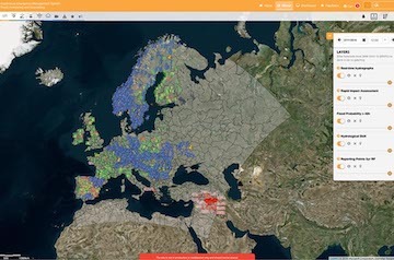
The workshop described the three ways to access EFAS hydrological data: EFAS-IS, FTP service, C3S Copernicus Climate Data Store (CDS). First covered was accessing WMS and layer product files from EFAS-IS: the presentation explained how to access the data and what type of data are available using these methods. Afterwards the process of requesting access to EFAS data via FTP was described, and again what type of data are made available via the FTP. Described last were the EFAS entries on the C3S Copernicus Climate Data Store (CDS): different data available and different opportunities for retrieval (interactive download form and API). The next part of the workshop was a live demonstration of a Jupyter notebook that allows to retrieve data via the CDS API and create plots. The participants were then invited to work through a demonstrative Jupyter notebook on Google Colab.
Accessing and downloading Global Flood Monitoring products
The workshop started with a brief description of how GFM algorithms use Sentinel-1 (Copernicus Programme satellite constellation conducted by the European Space Agency) backscatter data to detect flooded pixels. The presentation included an overview of the limitations of the algorithms. The next part of the workshop was a live demonstration of the GFM output layers. GFM output layers can be accessed by all EFAS partners/third parties through the EFAS IS and the GFM portal: this page explains how to use GFM data in EFAS. The demonstration showed the following GFM products: observed flood extent, reference water mask, advisory flags, exclusion mask, and Sentinel-1 related metadata. The GFM output layer Sentinel-1 schedule offers the planned acquisition segments for the upcoming 3 days. The current Sentinel-1 constellation can leverage only on one satellite (Sentinel-1A), however, higher acquisition frequency will be achieved after the launch of Sentinel-1C. The live demonstration then explained how to set-up the Areas Of Interest (AOIs) to download GFM product layers, including the maximum flood extent product, and how to set GFM notifications in EFAS. The final part of the workshop was an open discussion having the purpose of gathering participants’ ideas, needs, and suggestions. One prominent suggestion was the provision of a "flood duration map" which should indicate when in time a pixel was flooded for a certain time period.
Market place: CEMS centres booths
The market place was a highly interactive activity during which on-site participants were able to learn more about EFAS and GFM products and protocols, discuss specific topics with members of the operational centres and of the JRC, request for help, raise issues. Furthermore, on-site participants were encouraged to share their feedback and suggestions by adding their votes and writing their notes on the posters in display. 10 booths were installed in the meeting venue to enable a lively, relaxed (participants were reminded to grab a coffee!), and productive conversation. Due to the nature of this activity, the market place was available only to on-site participants. The collected feedback for each topic will be subject to thorough analysis and the outcomes will be published in the upcoming months. Those who could not attend the EFAS AM in person are encouraged to share their thoughts by contacting efas@info.eu.
The 10 booths are briefly described below.
HYDRO – how to share hydrological in situ data
This help desk provided a space to learn how to share water level, discharge, reservoirs data: minimum requirements, metadata, licence, and and modalities for data transmission. The CEMS HYDRO team had fruitful conversations with several providers, the list includes (but it is not limited to) the Service Public de Wallonie (Belgium), Israel Hydrological Service- Water Authority (Israel), Friuli Venezia Giulia (Italy) Civil Protection, Hellenic National Meteorological Service (Greece), Meteorological and Hydrological Service of Croatia, and the Federal Ministry of Agriculture (Austria).
METEO – how to share meteorological in situ data
This help desk provided the opportunity to discuss the list of variables, the minimum requirements (metadata), the licence agreement, and modalities for data transmission. The CEMS MDCC team discussed with several providers about ongoing changes and chances for further data exchange. These providers included the Hellenic National Meteorological Service and Friuli Venezia Giulia (Italy) Civil Protection about the exchange of real-time data; the Irish National Meteorological Service (Met Éireann) about the use of their CAMP stations; the National Meteorological Service of Slovenia about a potential API coming in the next years. CEMS MDCC also had fruitful conversations with the Estonian Environmental Agency and ARPA Lombardia (Italy). Moreover, the planned change from the Automatic system of hydrological information in Spain (SAIH) to the WISKI Software, which could make data exchange easier in the future, was discussed during the market place.
EFAS products - help desk
This help desk was managed by CEMS COMP and offered the opportunity to discuss into detail EFAS products, data, and operational set-up.
Open Source LISFLOOD - help desk
The open-source hydrological model LISFLOOD is at the core of EFAS forecasts. The model is spatially distributed and physically based. This help desk facilitated conversations around the main hydrological processes, the open-source suite, the online documentation, and the datasets that are openly available for model implementation: EFAS v5.0 static maps and EFAS v5.0 historical meteorological forcings.
Global Flood Monitoring products – help desk
This booth offered an overview of the Global Flood Monitoring: available products and data access. It also offered the opportunity to discuss technical details of the scientific methodologies implemented to retrieve information about inundation extent from Sentinel-1 (Copernicus Programme satellite constellation conducted by the European Space Agency) active radar satellite images.
EFAS Notifications feedback and Missed Events report – help desk
This help desk offered live tutorials on how to submit feedback on EFAS notifications and/or report a missed event via the EFAS IS.
EFAS Notifications message – share your ideas
This booth gathered feedback on the following questions: do EFAS Notification messages provide all the relevant piece of information in a clear and concise manner? What is missing? What is not essential? The EFAS partners/third parties were invited to cast votes and write their ideas on a poster. Some of the suggestions were: adding more information about the location of the event, add a link that points directly to the notification point or to the relevant EFAS IS layers, add expected peak time in Flash Floods notifications message, review the distribution lists for large basins, translate the messages into national languages.
EFAS IS Functionalities – share your ideas
This booth had the scope to collect feedback about the EFAS partners/third parties’ experience with: TAMIR animated impact forecasts; EFAS dashboard; EFAS mobile and tablet interface. The booth also highlighted a new proposal: a new interactive feature that allows users to dynamically request a hydrograph for a section of a river (in addition to the pre-generated reporting points). With this new feature, the users will also be able to download the values of the data shown in the hydrograph. The EFAS partners/third parties were invited to cast their votes and write their ideas on a poster. The proposal of the new interactive feature that allows users to dynamically request a hydrograph for a river section was welcomed by the EFAS partners/third parties.
EFAS Post Processing – share your ideas
This booth provided an opportunity to discuss improvements to the visualization and communication of post processed forecasts (e.g. showing fewer quantiles and adding vertical lines for the different lead-times). The EFAS partners/third parties were invited to cast votes and write their ideas on a poster. Some of the suggestions were: showing fewer quantiles and adding vertical lines for the different lead-times; adding a link to the post-processed forecasts in the EFAS notifications as post-processed forecasts help closing the gap between EFAS forecasts and the local forecasting systems.
EFAS Seasonal Forecasts – share your ideas
This booth aimed to gather suggestions from the EFAS partners/third parties on how to imprve the information provided by the EFAS seasonal (and sub-seasonal) layers. EFAS partners/third parties’ focus on medium range flood forecasts, therefore, they have small interest in EFAS seasonal (and sub-seasonal) layers. EFAS seasonal (and sub-seasonal) layers and products are relevant for land and water manages (navigation, water use for irrigation-industry). Nevertheless, the CEMS Flood team was interested in hearing the valuable expert opinion of the EFAS partners/third parties. A poster provided an overview of the products which are currently available in the EFAS IS, ideas for alternative or complementary information were derived from GloFAS IS. The poster was highly interactive, with many sections requiring active response from the partners/third parties. Some of the feedback were: aggregated regions were generally considered too large, conversely, more relevant information should be provided at a basin level (and not across an admin district); outlooks beyond 12 weeks (up to 6 months?) would be useful for some applications; no need to sub seasonal and seasonal products (difference between them unclear); for long forecasts, variable time aggregation could be useful (e.g. weeks for first few weeks, months afterwards); persistence table shown on GloFAS useful, but reporting points layer map without forecast information (only black dots) was not deemed useful.
Collection of questions and answers from the plenary sessions
Is the technical documentation about quality check protocols for hydrological and meteorological observations available? Yes, updated technical documentation about quality check protocols is provided in the Annual Reports of CEMS HDCC and CEMS METEO.
The discrepancy between EFAS forecasts and real events can be caused by erroneous initial conditions. How frequently the initial conditions are updated using in-situ observations? The pop-up window of each reporting point shows when the last observation was available and used. The icon “degraded” on the top right of the EFAS Map Viewer notifies the instances when not all the observations are available.
Have you considered using satellite-derived meteorological data for model initialization as a supplement when in-situ observations are not available/late? Yes. However, the operational implementation is not trivial, and further discussions on feasibility are needed.
Could the partners/third parties share with EFAS their own official warnings? In this way, it would be straightforward to compare EFAS notifications and partners/third parties official warnings. This idea could be implemented in the frame of the common alerting protocol.
Are GFM products available for past floods? From which year? Yes, the GFM archive starts from the launch of Sentinel-1 (Copernicus Programme satellite constellation conducted by the European Space Agency), that is from 2014.
Which EFAS webinars are available online and where? All EFAS webinars have been recorded and they are available from this page.
Is the Copernicus 30m DEM used within EFAS? The Copernicus 30 m DEM is not used in the LISFLOOD-OS implementation set-up for EFAS v5.0. At the time of preparation of the LISFLOOD-OS implementation set-up for EFAS v5.0, the Copernicus 30m DEM was not yet available. The 90 m MERIT-DEM was used for the LISFLOOD-OS implementation set-up for EFAS v5.0. However, it is planned to test the usage of the Copernicus 30 m DEM to produce a revised version of the EFAS flood hazard maps. Moreover, the computation of GFM products make use of the Copernicus 30 m DEM.
Does EFAS provide information to the World Meteorological Organization in the frame of the initiative Early Warnings For All? National services are the first and main source for WMO, EFAS forecasts are by mandate complementary to information from National services. Nevertheless, this is an idea worth discussing.
Which are the Flash Flood products? Which Flash Flood product is more trustworthy? EFAS Flash Floods notifications are currently based on ERIC. The new TAMIR products are not yet used for notifications because more verification is needed.
Reservoirs data are often owned by private companies and EFAS partners/third parties/data providers do not have access to those data. What are the possible solutions? CEMS HDCC will collect the data which are available to the EFAS partners/third parties. The integration of available information with satellite altimetry data is being discussed.
Review of the EFAS notifications criteria: where flood events identified using observations? No, flood events were identified using the EFAS water balance simulation. This solution was necessary because there is no consistent database of observed flood events across Europe.
Review of the EFAS notifications criteria: how often the criteria should be updated? The analysis was done using EFAS v4 data, it will be repeated when enough EFAS v5 data are available. In theory, the analysis should be repeated after each major release which leads to large changes in the hydrological modelling chain.
Bonus: the ice-breaker quiz
Upon request of many participants, the ice-breaker quiz is available here. Congratulations to team number 4 for achieving the highest score!
Conclusions
After two days of interesting and engaging talks it can be concluded that it is valuable to meet face to face, because it makes the interaction between the participants much easier and the informal and spontaneous chats and discussions over a coffee or around a poster really make a difference. The hybrid form of the meeting is a good opportunity for those who cannot make it to the venue.
The JRC and the CEMS Flood centres express their gratitude to all the participants for providing their feeback, sharing their experience, and providing suggestions for improvement. Information collected during the meeting is being analyzed in order to identify feasible solutions for improvement. Actions taken will be communicated via email and news items.
The next EFAS annual meeting will take place in September 2024, location and dates to be defined: all EFAS partners/third parties will receive an email in March 2024!
Presentations and posters
The presentations and posters of the 18th EFAS Annual meeting are available below:
Status of EFAS operational – experiences, issues, challenges:
CEMS Meteorological Data Collection Centre by Markus Ziese
CEMS Hydrological Data Collection Centre by Tomas Jacobson Prestigiacomo
CEMS Hydrological Forecast Centre - Computation by Christel Prudhomme
CEMS Hydrological Forecast Centre - Analytics and Dissemination by Ilias Pechlivanidis
CEMS Global Flood Monitoring by Christain Krullikowski
UCPM operations for floods: EFAS through the eyes of ERCC
ERCC and its Situational Awareness Sector by Olimpia Imperiali (DG ECHO)
Everything you need to know about EFAS version 5.0
Everything you need to know about EFAS version 5.0 by Cinzia Mazzetti (CEMS COMP)
EFAS Partners/third parties contributions
A Microsoft Teams site devoted to exchange of information during a flood situation by Michael Antoine, Bruxelles Environnement (Belgium)
Integration of EFAS forecasts into the flood forecasting system of Brandenburg/Germany by Maik Renner, LfU Brandenburg, Hochwassermeldezentrale (Germany)
From hydrological to impact based forecasts by Tali Horowitz, Israeli Water Authority (Israel)
Devastating floods in Thessaly, Greece 4-7 September 2023 by Artemis Papapetrou, Hellenic National Meteorological Service (Greece)
Probabilistic 6-week-forecasts for the German waterways by Dennis Meißner and Bastian Klein, BfG (Germany)
- Flood-events in Austria: August 3-7th and 27-29th 2023 by Petra Lalk (see the full list of authors in attachment), Austria Federal Ministry of Agriculture, Forestry, Regions and Water Management
Annual report on the flood events for 2022 in Bulgaria by Georgy Koshinchanov (see the full list of authors in attachment). Bulgaria National Institute of Meteorology and Hydrology
MeinePegel.App by Germany by Natalie Stahl-VanRooijen, LfU Bayern
Facilitating EFAS communication – modification of the EFAS conditions of access
Ongoing and upcoming developments in EFAS
An assessment of the EFAS notifications criteria by Jesus Casado Rodriguez (EC JRC)
EFAS notifications in 2022, feedback collection: summary and awards! by Nina Bosshard and Svea Bertolatus (CEMS DISS)
CEMS Hydrological data collection: reservoirs data by Alejandro Serratosa (CEMS HDCC)
CEMS Meteorological data collection: new data validation framework by Zora Schirmeister and Carina-Denise Lemke (CEMS MDCC)
Workshops
Workshop I: EFAS Flood Hazard Maps and Rapid Risk Assessment by Calum Baugh (CEMS COMP), online support by Claudia D'Angelo (EC JRC)
Workshop II: EFAS pre-tasking by Michaela Mikuličková, Nina Bosshard, Ilias Pechlivanidis (CEMS DISS)
Workshop III: How to access EFAS data by Dimitar Tasev and Eleanor Hansford (CEMS COMP)
Workshop IV: How to access and download GFM products by Tobias Stachl and Christian Krullikowski (CEMS GFM)
Market place posters
CEMS HDCC – how to share hydrological in situ data - help desk by Carina-Denise Lemke, Zora Schirmeister, Markus Ziese, Christoph Schweim (CEMS MDCC)
CEMS MDCC – how to share meteorological in situ data - help desk by Rafael Garcia Sanchez, Tomas Jacobson Prestigiacomo, Alejandro Serratosa, Antonio Jimenez Molina, Mercedes Garcia Padilla (CEMS HDCC)
Open Source LISFLOOD - help desk by Stefania Grimaldi, Jesus Casado Rodrigues, Carlo Russo (EC JRC)
Global Flood Monitoring products – help desk by Tobias Stachl, Christian Krullikowski (CEMS GFM)
EFAS Notifications message – share your ideas! by Nina Bosshard, Michaela Mikuličková (CEMS DISS), Calum Baugh (CEMS COMP), Jesus Casado Rodriguez, Stefania Grimaldi (EC JRC)
EFAS IS Functionalities – share your ideas! by Dimitar Tasev (CEMS COMP)
EFAS Post Processing – share your ideas! and informative poster by Gwyneth Matthews (CEMS COMP)
EFAS Seasonal Forecasts – share your ideas! by Christelle Prudhomme (CEMS COMP)