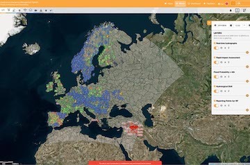
Copernicus Emergency Management Service (CEMS) Risk & Recovery Mapping (RRM) supports disaster management activities not related to immediate response, including prevention, preparedness, disaster risk reduction and recovery phases. The service covers natural and man-made disasters (e.g. flood, fire, earthquake, storm, industrial accidents) anywhere in the world and is free of charge for users.
RRM allows users to request a range of products, based on their needs. By providing locally relevant information, the RRM products are relevant at city and regional level and can support processes such as cost-benefit analysis of major investment projects for disaster prevention and climate change adaptation and help effective investments under the European Structural and Investment Funds. In relation to floods, the RRM service can support activities of flood risk management to fulfil the requirements of the Floods Directive.
The performed analyses are based on satellite imagery and in-situ data, with the possibility to integrate information offered by the users. The main output of the analyses is the geospatial data, which can be then inserted in the geospatial information systems of the users to further develop on them. Apart from the vector and raster datasets, the deliverables include symbology layers, ready to print overview maps, metadata and an informative report including all the specifications on the imagery and data used, the methodologies applied and results.
In relation to pre-disaster activities, RRM service can provide information on the exposure, vulnerability and risk of people and assets. It can also offer detailed post-disaster assessment and assist in the development of recovery plans.
The service can be activated through two modalities:
FLEX mode: which accommodates tailor-made studies to support specific needs from the users. The FLEX mode covers a wide variety of situations for pre-disaster, post-disaster and reference mapping. The activations are developed under specific contracts after a tendering process. The products delivery is flexible, usually 1-2 months, depending on the specificities of the activation.
An example of a past FLEX activation in relation to floods is the EMSN056: Historic flood delineation and analyses for Elbe/Vltava catchment. The analysis covered one of the largest floods in Central Europe (summer 2013), affecting Southern and Eastern Germany and some areas in Czech Republic, Austria and Switzerland. The purpose was to improve the understanding of the flood event dynamics. The analysis included the delimitation of the flood extent during more than one month for every available source not analysed before and the chronological comparison of results to provide information on the evolution of the event. A wide number of images, including SAR and optical, were processed to maximise the spatial and temporal coverage of results.
Another example is activation EMSN054: Assessment of flood risk and economic impact, Drin river basin, Balkans that provided relevant information for risk preparedness (hazard, historical floods and economic risk assessment) and sustainable development (economic assets mapping, economic risk assessment).
STANDARD (STD) mode: a set of predefined standard products are offered to cover typical user needs. The products have a predefined methodology and scale, and results are offered in a period ranging from 5 to 15 days.
In relation to floods, the more relevant products are:
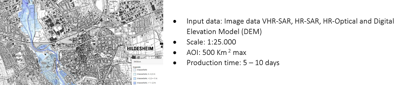
Flood Delineation (P04)
Flood delineation product is the spatial characterization of the flood event, both in terms of delineation and water level.
Derived from the best available SAR (VHR and HR) and optical imagery (HR), it describes the flood extent as close as possible to the crisis, having a pre-event hydrological information as reference.
Linking results with Digital Elevation Model (DEM), allows for the estimation of the flood water levels at its peak. Reference hydrography from the Reference dataset is required to distinguish the normal water extent from the floodwater inundated area.
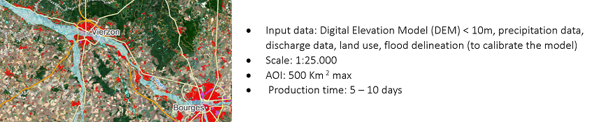
Modelled Flood Extent for Major Events (P05)
Provides modelled, simulated flood extent, information about the flood based on estimate discharges and water levels using statistical methods or modelling of the hydrologic cycle (runoff models).
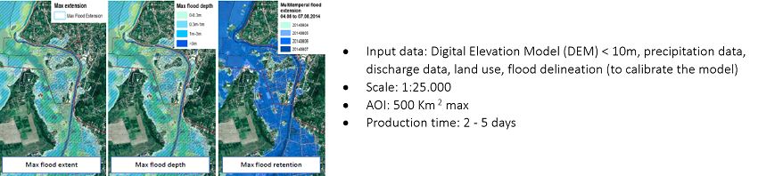
Temporal Analyses of Occurred Flood Events (P06)
Provides temporal analyses of flood events within a defined area of interest. P06 is based on hydrological modelling and calibrated by time series of flood extents (P04 or similar) for the occurred flood event. As a result, P06 offers the maximum flood extent, maximum flood depth and maximum flood retention (time during which the location was covered with water).
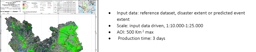
Impact Assessment/Exposure Analyses on Assets and Population (P14)
Allows two types of analysis:
- impact assessment on assets and population for events where a disaster extent is available; and
- exposure analysis on assets and population in the case of a predicted/modelled event.
The main outputs of this product are general statistical information about assets and population exposed during or affected by an event, presented in tabular form, coupled with intermediate results of spatial statistics per asset type.
Detailed Impact Assessment/Exposure Analyses on Selected Aspect (P15)
As for P14, both impact assessment and exposure analysis can be provided. In this case, the analyses focus on selected thematic aspects (i.e. agriculture production and crop, forest stand information, economic values).
The main outputs are detailed statistical information on a selected asset exposed/affected during an event, presented in tabular form and as descriptive part in the report using tables and graphs. Additionally, the intermediate result of spatial statistics is delivered.

Activations EMSN068: Germany, Brandenburg flood mapping and EMSN069: Germany, Herne city flood preparedness are examples of pre- and post-disaster studies, respectively, related to floods under Standard mode.
For further information check the RRM portal https://emergency.copernicus.eu/mapping or contact JRC-EMS-RISKRECOVERYMAPPING@ec.europa.eu.