By Christel Prudhomme, Cinzia Mazzetti and the whole team of the EFAS Forecast Computational Centre.
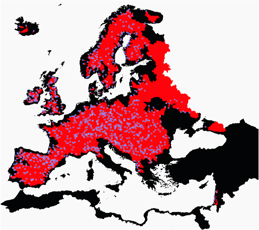
On the 14 October 2020, the European Flood Awareness System (EFAS) launched a new cycle upgrade, EFAS version 4.0. It introduces a step-change in the way river discharge is simulated and flood warnings are calculated, with twice daily medium-range ensemble forecasts driven by ECMWF-ENS now provided at a 6-hourly time step — a 4-fold increase in the temporal resolution compared with the daily time step issued up until now — and statistical post-processed forecasts available on over 1000 stations. EFAS v4.0 follows a complete recalibration at 6hourly time step at over 1100 river stations across the EFAS domain covering 50% of the full spatial domain (Figure 1).
Hydrological modelling
The hydrological model was calibrated using sub-daily and daily discharge data provided by EFAS partners up to July 2018.
However, additional river gauges shared by EFAS partners and managed by the Hydrological Data Collection Centre (HDCC) after that date have been included as fixed reporting points where partners can monitor EFAS simulations over their catchment of interest. As part of the continued evolution of the service, new fixed reporting points are added regularly by the team through the publication of new EFAS versions.
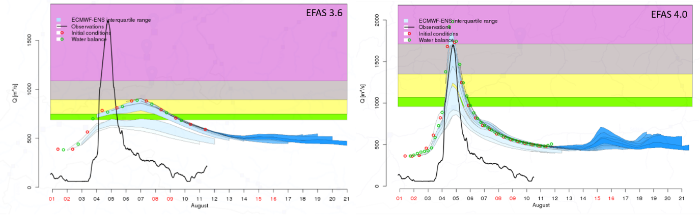
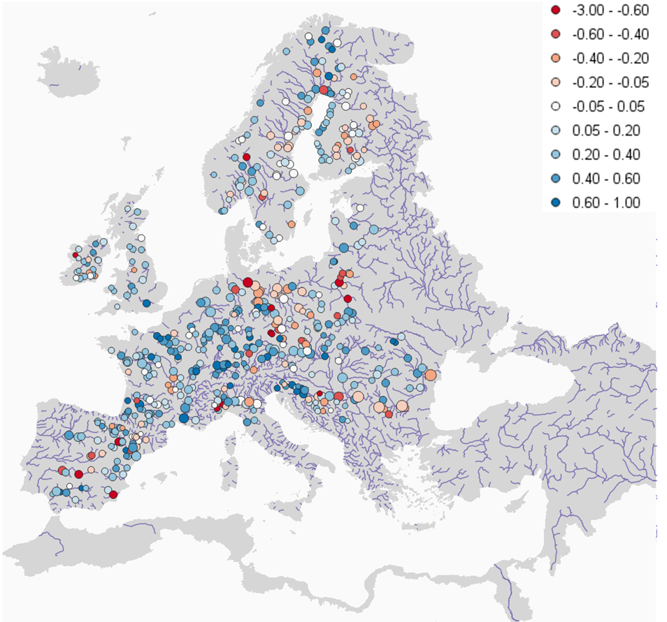
The new calibrated LISFLOOD model produces marked improvements in both the magnitude and timing of simulated flood peaks, especially in medium-size catchments (Figure 2). The Kling-Gupta Efficiency increase for 400 of the 540 common calibration points from EFAS3.6 to EFAS v4.0 (Figure 3).
Enhanced information for users
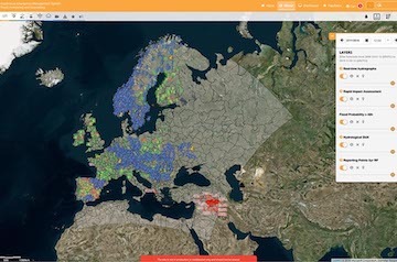
To help users interpret EFAS forecasts, we added new layers describing the way LISFLOOD represent rivers and locates reservoirs and lakes (available under the ‘Static’ tab in EFAS-IS map-viewer menu). We also made some changes in the way the information is displayed. For example, we introduced a new ‘evaluation’ tab where summary of the hydrological model performance (see Fig 4) and forecast skills are provided.
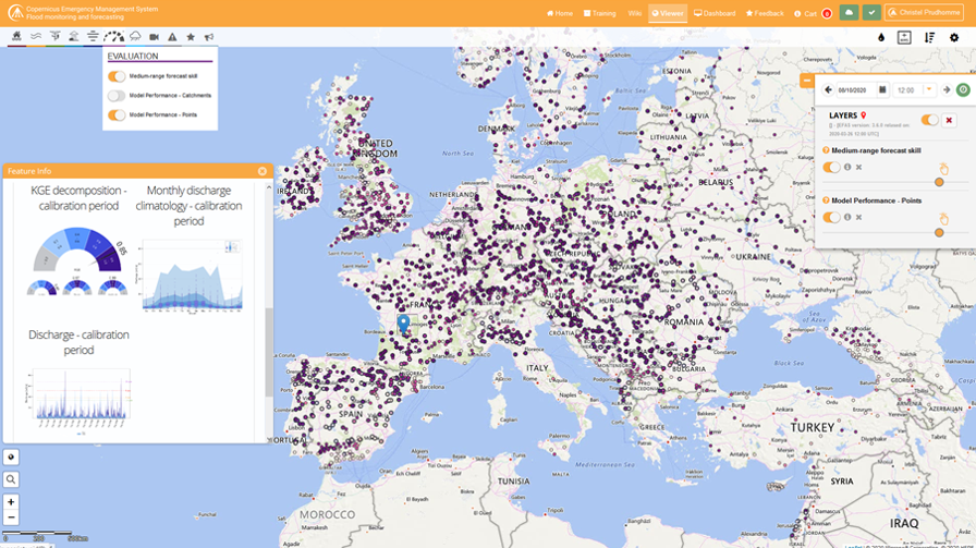
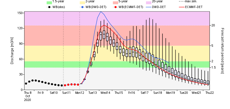
The pop-up windows associated with the ‘Reporting Point’ layers have been redesigned, with the discharge forecasts hydrographs (Figure 5) and post-processed forecasts (for those stations with real-time river discharge data available through the HDCC) available together, so that users can easily compare the simulations and forecasts with their own observations. The persistence tables have been reconfigured for a more intuitive reading, with the latest forecasts now on top of the figure. The information is provided for all the 2651 EFAS fixed reporting points of EFAS version 4.0.
Finally, we also are now publishing all produced EFAS datasets through the Copernicus Climate Data Store. In addition to the already available 30-days old EFAS real-time forecasts and the EFAS historic simulations since EFAS-2, now also real-time EFAS seasonal outlooks and ECMWF-based EFAS medium-range and seasonal reforecasts are part of the CDS so that users can conduct their own local evaluation and use data for downstream applications.
Additional Information
Supplementary documentation detailing the EFAS system (model, products, and service) and its upgrades are provided through dedicated Wiki pages publicly available at: https://confluence.ecmwf.int/display/COPSRV/European+Flood+Awareness+System
A new medium- to sub-seasonal range reforecast, seasonal forecast and seasonal hindcast datasets have also been released with EFAS v4.0. Seasonal and seasonal reforecasts datasets will be available from ~10 November 2020 following the first seasonal forecast in EFAS v4.0. The reforecasts are available through the CDS: https://doi.org/10.24381/cds.c83f560f