The latest version of the European Flood Awareness System, EFAS v4.7, is to be released operationally ton Monday 12 December 2022.
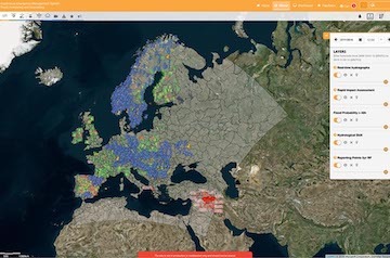
This release will enable the visualisation of the new Global Flood Monitoring (GFM) products in the CEMS EFAS map viewer. The GFM provides continuous monitoring of floods worldwide, by automatically processing and analysing in near real-time all incoming Synthetic Aperture Radar imagery acquired by the EU’s Copernicus Sentinel-1 satellites.
The GFM product is based on 3 different flood detection algorithms running in parallel and is composed of 11 different layers, roughly grouped into 4 categories: water bodies (Observed Flood Extent, Observed Water Extent, Reference Water Mask), uncertainty-related (Exclusion mask, Uncertainty values, Advisory flags), S1 data specifics (metadata, footprint, schedule) and impacts estimate (Affected population, Affected land cover).
With a spatial resolution of 20m and a revisit time ranging from 3 to 14 days depending on S-1 overpasses, the full dataset of the product output layers is made available in raster format both separately and in bulk.
The information about the specifics of the GFM products and how to access the data are provided through the Product User Manual and the Product Description Document available here.