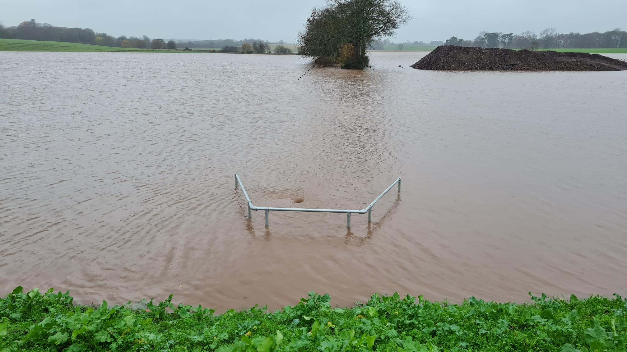
Heavy rain fell across Scotland from 16 November 2022, causing significant flooding across wide areas of the east of the country.
Rainfall
The UK’s Met Office said close to a month’s worth of rain fell across parts of Aberdeenshire and Angus in 48 hours to 18 November. As much as 140mm of rain was recorded in Charr in Aberdeenshire. The village of Aboyne in Aberdeenshire recorded 71.4mm of rain in 24 hours on 18 November.

Rivers
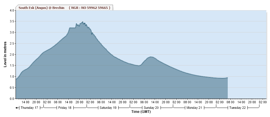
Scottish Environment Protection Agency (SEPA) said “We are seeing significant impacts from rivers in parts of Aberdeenshire and Angus. Seven severe flood warnings are live in Kintore, Kemnay, Inverurie, Ballater and Aberdeen, Brechin and Finavon, and Tannadice.”
Damage
One person was reported missing after being swept away by flooding along the River Don near Monymusk in Aberdeenshire on the afternoon of Friday, 18 November.
Aberdeenshire Council opened rest centres in Ballater, Aboyne, Inverurie and Kemnay for those needing help and who are unable to stay in their homes. Local media reported residents of Ballater were preparing for severe flooding as levels of the Muick and Dee rivers were rising. Around 40 caravans were evacuated from Ballater Caravan Park.
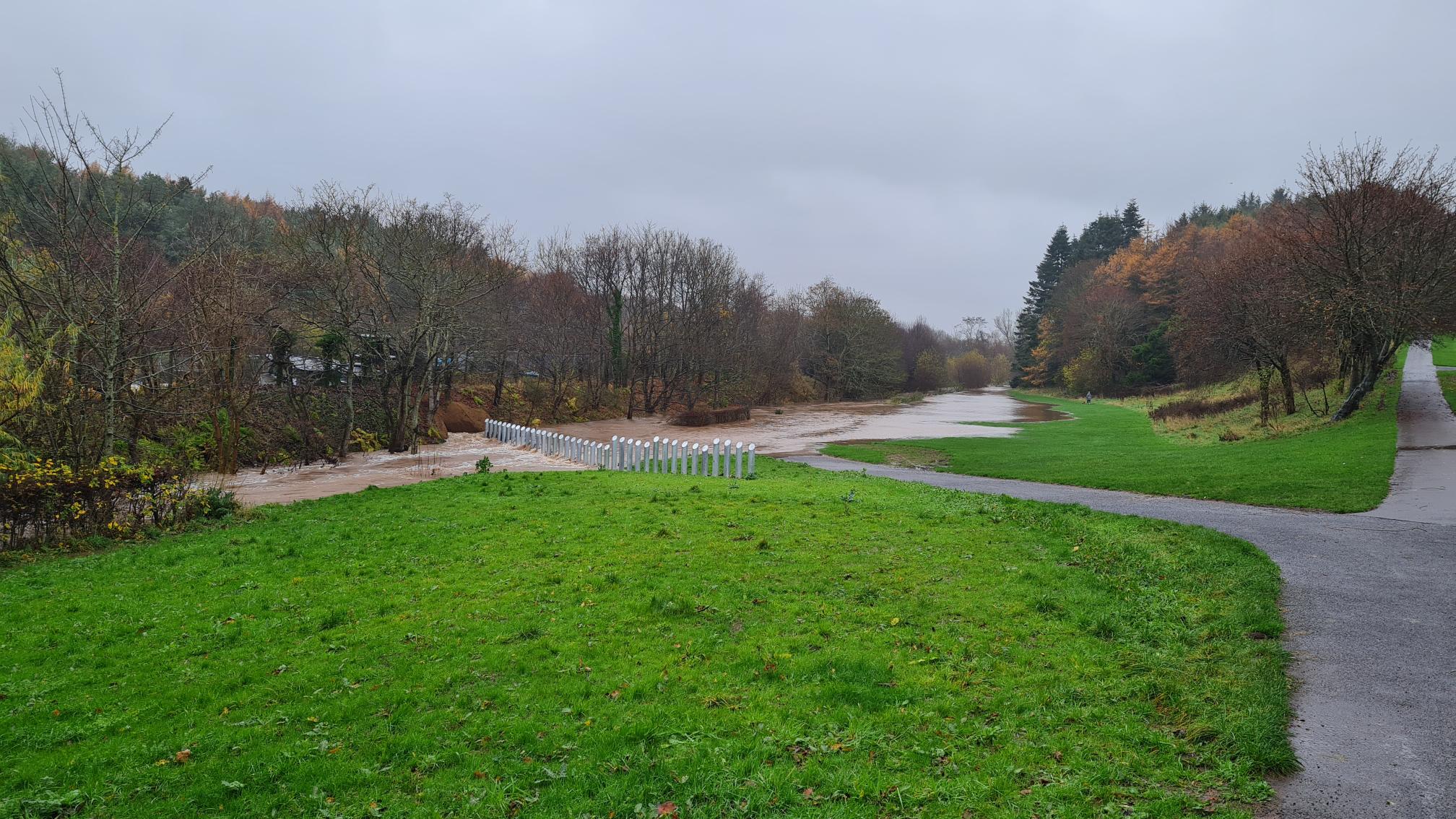
Rail services were severely impacted, and hundreds of travellers were left stranded. Several roads were flooded in Aberdeenshire as well as parts of Angus, Fife, and Dundee districts. Scottish Fire and Rescue Service said “Our Operations Control rooms are receiving a high number of emergency calls due to flooding in Brechin, Forfar and Dundee. We ask the public for their co-operation. Please only call if there is a serious emergency with risk to life.”
Cars were seen partially submerged along a major road near Ladybank in Fife. Some residents evacuated their homes in Brechin. Localised flooding was reported in areas of Edinburgh, leaving vehicles stranded.
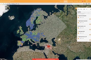
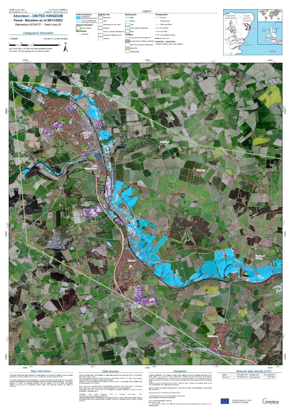
Copernicus EMS
Copernicus Emergency Management Service Mapping was activated on 18 November. See EMSR640: Flood in Scotland, United Kingdom for more.
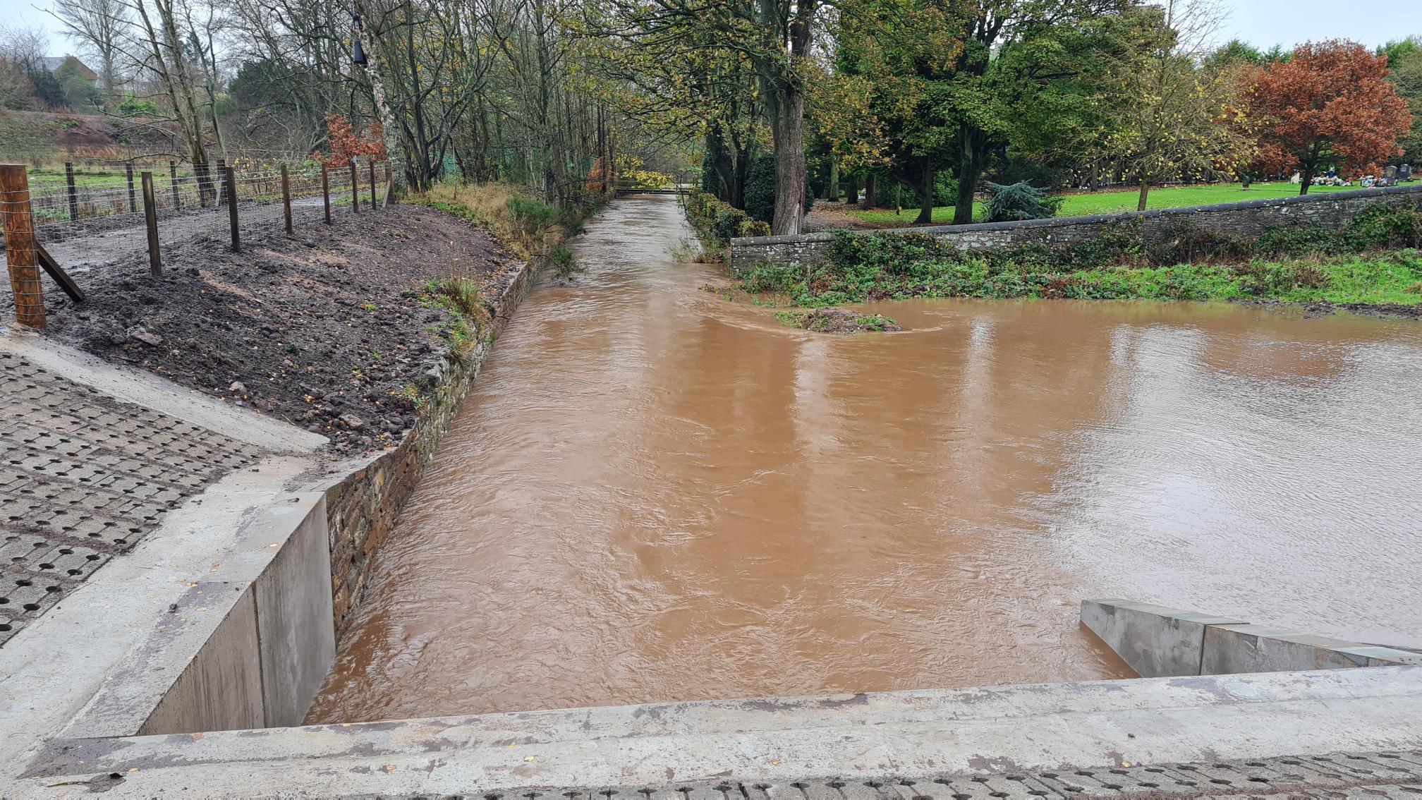
Arbroath Flood Protection Scheme
Despite the heavy rainfall, a recently developed flood protection scheme in Arbroath, Angus, kept high waters of Brothock water away from buildings in the town.
Eleanor Doyle, engineer at Angus Council, explained that there are three flood storage areas for the scheme, two of which are located out with the town and the third is located on parkland in Arbroath that is a historic flood plain area. The bank and wall protections along the Brothock through the towns were strengthened and heightened as required. The inclusion of the storage areas limited the height requirements for flood walls in the town which would have been required to be too excessive to contain a 1:200yr flood.
“The scheme is still to complete but thankfully operated as designed,” Eleanor Doyle said.
See more about the Arbroath (Brothock Water) Flood Protection Scheme here.