by Richard Davies, floodlist
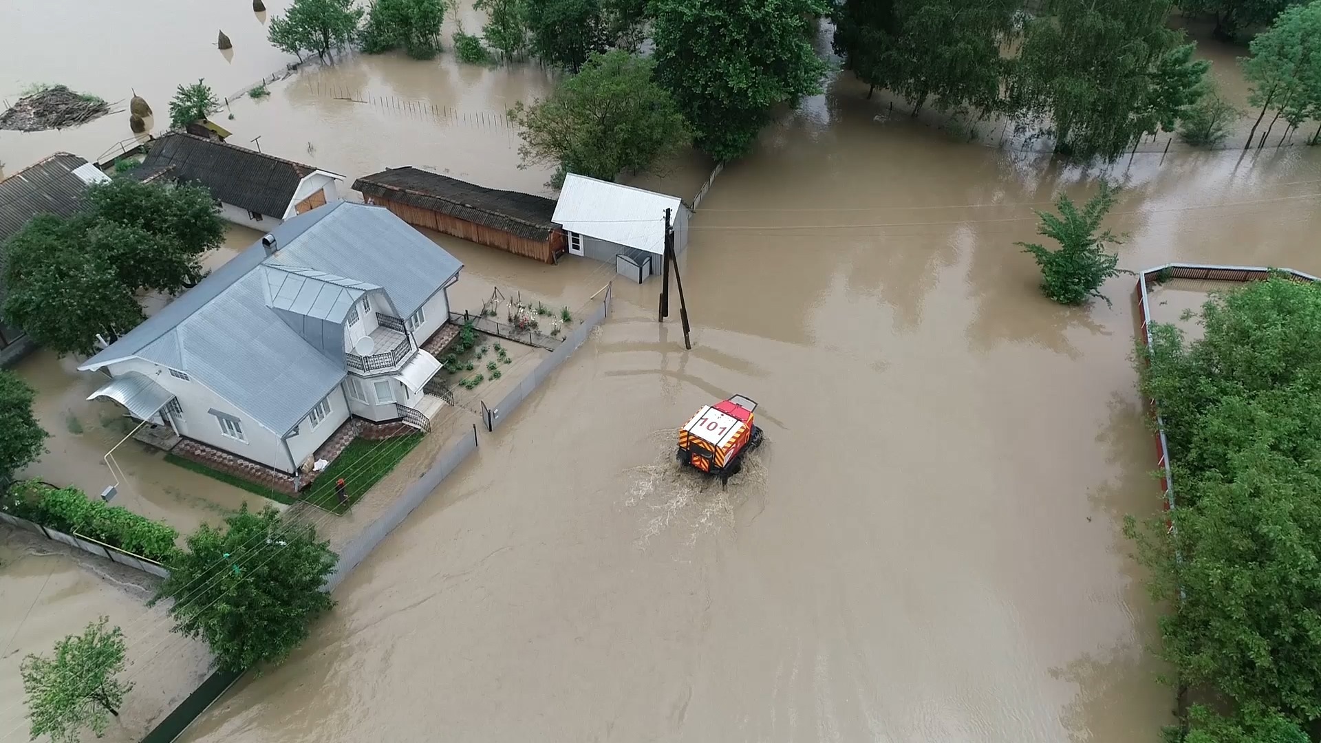
Ukraine’s western regions were ravaged by heavy rainfalls and flooding in late June 2020. The hardest hit areas were in Ivano-Frankivsk, Chernivtsi, Zakarpattia, Ternopil and Lviv regions. Thousands of homes were damaged, along with bridges and roads. Three people sadly lost their lives in the flooding.
Rivers and Rainfall
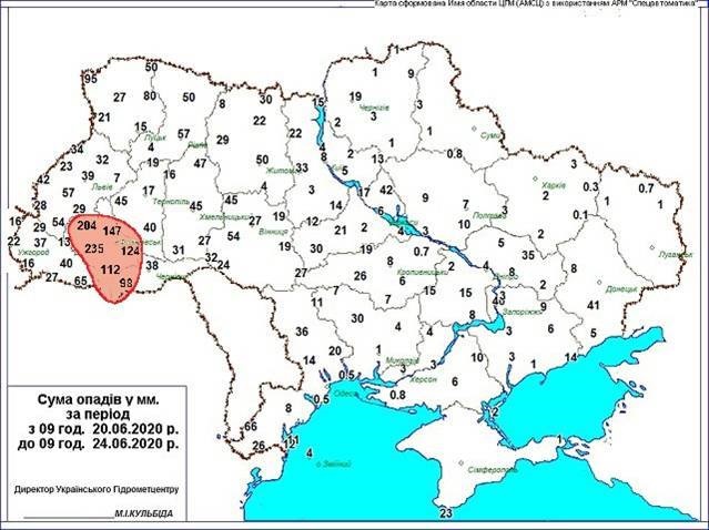
Figures from the Ukrainian Hydrometeorological Center show some areas recorded more than 200mm of rain during the period 20 to 24 June.
According to the State Agency of Water Resources of Ukraine, levels of the Siret and Prut rivers in Chernivtsi region rose rapidly. As of 24 June the Prut river at Tarasivtsi reached 8.04 metres. Ukrainian Hydrometeorological Center reports showed the Dniester river at Sambir in Lviv Region stood at 4.4 metres as of 24 June.
Flood Damage
Reports from the State Emergency Service of Ukraine (SESU) said over 14,000 homes were damaged by the floods across 342 settlements. Hundreds of people were rescued or evacuated from flooded areas by emergency services, including by helicopter. Around 1,500 people were moved to temporary accommodation in public buildings.
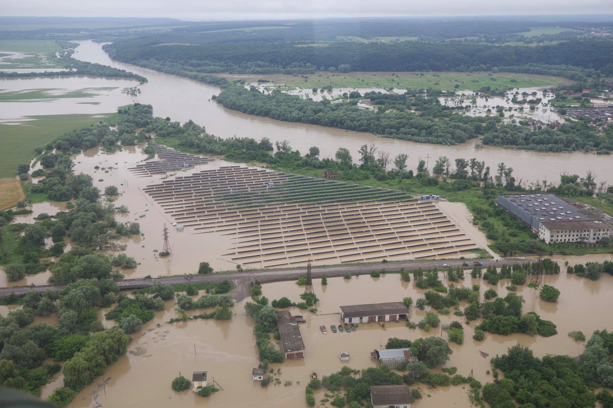
Swollen rivers washed away bridges and roads, flooded several dozen villages and cities, destroyed power lines and dams. Over 270 settlements were left without electricity.
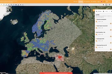
Copernicus Mapping
After the situation proved critical, the Copernicus Emergency Management Service (CEMS) Rapid Mapping service was activated on 25 June by the European Emergency Response Coordination Centre (ERCC) to map the areas located in the south-west of Ukraine. Maps of flood extent in western Ukraine for this event can be viewed on CEMS Mapping website.