16th EFAS Annual Meeting
The 16th EFAS Annual Meeting was again transferred to an on-line platform due to the Covid-19 pandemic situation. The meeting was part of the Copernicus Emergency Management Service Week 2021 that was organized with the aim to bring together experts, users and policy makers to discuss the future of CEMS. The meeting took place over two half days on 27 and 28 October 2021. In the first part of the meeting 174 participants from EFAS partners, third party partners and operational centres were logged in. In the second part 147 people participated. The EFAS Annual Meeting was organized by the Joint Research Centre (JRC) and the EFAS Dissemination Centre (DISS) with the support of all EFAS operational centres. EFAS/GLOFAS activities will continue in new framework contracts for the period 2021-2027. Contracts have been awarded in July 2021. The only change is that HYDRO continues with only Soologic. In the new framework contracts there is additional user support, more analytical service, additional and improved data validation procedures.
Achievements during the last year
EFAS DISS presented the 4 new full partners and 5 new third party partners that have joined EFAS since the last annual meeting. In 2020 240 formal, 159 informal and 1815 flash flood notifications were issued. In the period from January till September 2021 106 formal, 117 informal and 1283 flash flood notifications were sent to EFAS partners. The analysis of provided feedback showed that partners were more happy with the predictions than last year. Webinars were held – Use of EFAS 4.0 (December 10, 2020) and Rapid Mapping for Satellite pre-tasking (June 15, 2021). Both are recorded and uploaded on EFAS IS. The Annual Survey was not carried out during this virtual meeting; however, the partners will be requested to provide feedback on EFAS for the entire year 2021 and will receive a questionnaire in January 2022.
The EFAS Hydrological Data Collection Centre (HDCC) presented their Annual report 2020, in which 1149 discharge stations are analyzed. The percentage of stations for which threshold levels were exceeded has increased in the past year compared to the previous year but is still lower than the historical average between 1991 and 2015. Currently 1824 stations from 48 partners are providing water level or discharge data. EFAS HDCC has contributed to the event assessment report for the 2020 spring flood event in Scandinavia.
The EFAS Meteorological Data Collection Centre (MDCC) currently collects data from over 240.000 sensors and stations, does quality control checks on these data, runs automatic data aggregation and validation calculations, to prepare data for generation of gridded spatial information, that is used as input for COMP. A filter has been developed to detect and remove multiple stations and merge them into one station. This prevents overrating of multiple available stations and improves the performance of grid creation. Necessary minimum data coverage for including stations in post processing was reduced and acceleration of interpolation has been achieved. An annual overview report of the meteorological data collection in 2020 has been produced. This will be done every year from now.
Feedback collection
DISS highlighted one again the importance of feedback on issued notifications. Feedback is essential to improve the EFAS system. It helps to verify case studies, validate skill scores, assess the model performance and shape future developments. Presently feedback is collected on formal notifications, flash flood notifications but also on missed events. Feedback is analyzed on a yearly basis. A summary of the feedback of 2020 is available on the EFAS website. In the new framework contract feedback collection will be asked for all types of EFAS notifications.
In a parallel session partner feedback for flash flood verification was presented. The aim of the verification is to identify the optimal criteria for issuing flash flood notifications. Flash flood forecasts are compared against observations at the administrative region level. Observations are derived from media, but also from EFAS partners and from the European Severe Weather Database.
What’s new & next for EFAS?
The next version of EFAS is referred to as EFAS 5.0 or EFASNext. Important features of EFASNext are increased spatial resolution to 1 arcmin (~1.3 km), new meteo and hydro datasets with longer lead times, more stations and improved interpolation methods, new improved static maps and a new LISFLOOD calibration with more stations and longer calibration periods.
The higher spatial resolution leads to an improved representation of the drainage network and better modelling of small catchments. EFAS 5.0 will be operational by the end of 2022.
Performance of the EFAS system
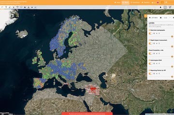
In EFAS IS a number of evaluation layers is available. The layers show performance and forecasting skill. For the hydrological performance 1137 observation stations from 1990 to 2017 with at least 4 years of data have been evaluated. Evaluation was done at 6-hourly time steps, but model series averaged to daily for stations with only daily data. The KGE efficiency metric gives information on correlation, bias and variability. Forecast skill refers to the relative accuracy of a set of forecasts, with respect to a set of standard benchmark forecasts. Benchmarks are persistence and climatology. Next steps will be to implement operational monitoring of forecast skill and scalability of evaluation products.
The CEMS Global Flood Monitoring Service GFM
GFM is a system based on 2 Sentinel-1 satellites that provides systematic coverage and near real time monitoring of land surfaces. A fully automatic process derives 11 output layers with a spatial resolution of 20 meters, including a flood extent map and uncertainty maps. A beta version of the GFM is available on the GLOFAS website since 27 October 2021 and will be integrated in EFAS-IS next year.
The European Coastal Flood Awareness System ECFAS
ECFAS is a Horizon2020 funded project for predicting coastal flooding. From hazard forecasting to flood mapping. ECFAS provides validated pan-European forecasts of total water levels at the coast (including the effects of ocean circulation, atmospheric pressure forcing, tides and waves). It provides thresholds that can trigger the awareness system. Total water levels will be produced as hourly time series of sea level forecasts along the EU coast. Flood impact forecasts will be made by combining water levels with information on population, buildings, land-use, transport and infrastructure. The result of the project will be a proof of concept that can possibly be integrated in CEMS.
The TAMIR project and the link to EFAS
TAMIR is a DG Echo funded project to enhance the response capacity in emergencies caused by convective and heavy rainfall events by developing rapid risk assessment products and IT tools for improved impact forecasting to support decision making. In TAMIR flash flood impact forecast products are developed to display on the EFAS website. Prototype of TAMIR products will be available in EFAS-IS and as web services by March-May 2022.
The South-East European Multi-Hazard Early Warning Advisory System SEE-MHEWS
South-East Europe has experienced a significant number of severe meteorological and hydrological hazardous events such as floods, extreme temperatures, severe storms, droughts, wildfires and landslides. National hydrological and meteorological Services are facing challenges to secure adequate financial and human resources to provide timely and accurate warnings. International cooperation can improve the quality of weather and water related information, forecasts and warnings. In the first phase (2016-2017) an implementation plan was prepared. Between 2018 and 2022 a pilot phase supporting the implementation of a prototype was conducted. In the period 2022-2026 an operational system should be implemented.
The recent floods in Germany, Belgium and Luxemburg in July 2021
The floods that happened in July 2021 in the catchments of Rhine and Meuse had tragic impact. EFAS can contribute to improve the situation and reduce impact.
EFAS performance during the July 2021 floods
The EFAS operational centres will produce a detailed assessment report about the July 2021 floods. The report will focus on the quality of EFAS model simulations and forecasts and the quality of the EFAS service. In the report that should be published in December 2021 it will be investigated whether notifications were sent to the appropriate recipients, whether they were used in forecast informed decision-making (if so, how) and whether the EFAS forecasts provide additional information over ‘home produced’ forecasts.
The July flood in Germany with focus on the Ahr basin and challenges in forecasting
In her presentation Margret Johst from the German State Environmental Agency Rhineland-Palatinate gave an introduction in the flood that happened in the Ahr basin between 14 and 15 July. The return period of the flood (based on 80 years measurements) is estimated to be larger than 1000 years. About 130 people died in the flood. Copernicus EMS was activated. 5 EFAS notifications were received. 1 of them was as predicted, 2 were in fact more severe and 2 were false alarms.
Summary
The meeting was full of information and organizers appreciated a lot that partners provided feedback and had many questions that could move EFAS forward. The EFAS annual meeting concluded with a hope that next year we will be able to meet again face to face.
EFAS Presentations
Below you can find the presentations given at the 16th EFAS Annual meeting:
What is new since the 15th EFAS Annual Meeting, and what comes next:
- Dissemination Centre (Ilias Pechlivanidis, DISS)
- Hydrological Data Collection Centre (Mercedes García Padilla, HDCC)
- Meteorological Data Collection Centre (Markus Ziese, MDCC)
- Short presentation of user feedback (Marc Girons, DISS)
- What is new & next for EFAS? (Vera Thiemig, JRC)
- A sneak preview at EFAS 5.0 (Cinzia Mazzetti, COMP)
Parallel breakout sessions "Performance“
- EFAS Evaluation layers 2.0 (Shaun Harrigan, COMP)
- How user feedback improves the EFAS service: station metadata & discharge timeseries, flash flood notifications, general feedback (Cinzia Mazzetti, COMP)
Everything you wanted to know about ...
- CEMS Global Flood Monitoring Service (Wolfgang Wagner, GFM)
- The European Coastal Flood Awareness System (Paolo Ciavola)
- TAMIR and the link to EFAS (Calum Baugh)
- SEE-MHEWS (Fredrik Wetterhall, COMP and Sari Lappi, )
Parallel breakout sessions: "Hydro-Meteo Data"
The recent floods in Germany, Belgium and Luxemburg in July 2021
- EFAS performance (Jan Verkade, DISS)
- national/regional flood forecasting work (Margret Johst, Flood Forecast Centre in Mainz)
EFAS meeting minutes
The minutes of the EFAS Annual Meeting 2021 can be downloaded here.
1st Global Flood Forecasting and Monitoring meeting (GloFAS & GFM)
As part of the CEMS week, the first GloFAS Annual Meeting was organized in the afternoon of 28 October. In this meeting 117 participants were logged in. Presentations were given on developments and use cases in GloFAS and the Global Flood Monitoring System.
GloFAS – highlights of the last year
GloFAS is part of the Copernicus Emergency Management Service (CEMS). The system couples information from numerical weather prediction with hydrological modelling to provide global flood forecasts for large river catchments. GloFAS is complementary to national hydrological and meteorological systems. Information from GloFAS is freely available and provides ensemble hydrological forecasts and is updated on a daily basis. GloFAS also contains a seasonal component that is updated weekly. Version 3.2 of GloFAS is available since 27-10-2021.
The flood risk assessment layers in GloFAS are comparable to EFAS. The rapid impact assessment layers gives information on lead time and exposure.
Global Flood Monitoring
A new operational, near real-time global flood monitoring system (GFM) has been integrated into GloFAS. The new GFM provides a continuous monitoring of floods worldwide by immediately processing and analyzing all incoming Sentinel-1 Synthetic Aperture Radar (SAR) satellite data. Information is obtained from 2 satellites for systematical monitoring of floods around the world. Three algorithms run in parallel to compute the near-real time flood mapping products.
GFM computes on a regular basis 11 different flood-related products, accessible via the hydrological layer tab of the GloFAS map viewer. Seasonal differences can be taken into account.
CEMS Hydrological Data Collection Centre (HDCC) for GloFAS
Given the fact that this was the first annual meeting for GloFAS within the Copernicus EMS, the setup of the Copernicus services was explained. JRC is responsible for the management and the future development of the EMS, but the operational work is contracted to a number of service providers. In a separate session the global hydrological data collection, one of the services of the operational CEMS was presented.
The GloFAS Hydrological Data Collection is outsourced to the Spanish company Soologic. Soologic (together with REDIAM) has been operating the EFAS HDCC since 2012. The new framework contract that starts 2021 includes data collection for Europe as well as for the global domain. The HDCC collects historical hydrological data and metadata, harmonizes the data, does quality control and data sharing within CEMS.
A first glimpse into GloFAS 4.0
GloFAS 4.0, also referred to as GLOFAS Next will be operational at the end of 2022. In the new version the spatial resolution will be doubled from 0.1 degree to 0.05 degree, the LISFLOOD model will be upgraded and the system will be recalibrated with new data. That way the river network will be better represented and eventually forecasts will improve. In GloFAS 4.0 catchments with an area over 500 km2 are calibrated (in the previous version this was 5000 km2).
Global use case and applications – Global user stories
In a number of user stories the application of GloFAS and the Global Flood Monitoring System was presented.
Two extreme flood events occurred in the 2020 monsoon in the Brahmaputra basin in Pakistan. The GloFAS forecasts hydrograph showed high forecasts probabilities for flood onset, peak time and duration with a lead time between 10 and 15 days. Bangladesh flood forecasting and warning centre plans to integrate GloFAS forecasts to the national model to predict water levels.
The World Food Program has been using an in house system called the automated disaster analysis and mapping system. Flood forecasting (river reporting points, inundation forecasts and rainfall forecasts) is coming in from GloFAS and from ECMWF.
The use of flood forecasts and the implementation of systems like GloFAS in Disaster Risk Financing was presented. The aim of DRF is to get the right amount of money where it needs to be in the right time. Forecasts are used for risk analytics. Financing an contingency planning will be rolled out based on risk assessment coming from forecasting systems like GloFAS.
An example was presented were GloFAS is used for risk analytics prior to river flooding. Insurance needs a probabilistic analysis of historical events and real time forecasts.
An example from a Swiss trader specialized in energy commodities was presented. Discharge forecast from GloFAS are used to forecast power production. GloFAS improved performances compared to persistency.
The Aristotle project aims at transboundary early earning. Aristotle provides guidance on 6 types of natural hazards to the EU Emergency Response Coordination Centre (ERCC). This guidance is used by the ERCC to coordinate preparatory and response actions to global natural disasters. Information from GloFAS is used for the flood hazard part in the guidance reports.
Case studies on how GloFAS and GFM complement each other for Thailand, China, India and Mexico were presented. It was concluded that GloFAS is not perfect but usable.
GloFAS and GFM Presentations
Below you can find the presentations given at the 1st Global Flood Forecasting and Monitoring meeting:
GloFAS - highlights of the last year
- overview on GloFAS 3.1 (model, evaluation layers, forecast summary, limitations) - by Ervin Zsoter
- From hazard to impact forecasting (principle of impact forecasting, example of exposure) – by Calum Baugh
- Web and data services (CDS, WMS-T, ftp) – by Christel Prudhomme
- Methodology – Quick intro on GFM, explanation on the used methodology to generate flood extent maps, algorithms involved, data cube concept with SAR ARD – by Wolfgang Wagner
- Products outline – Available product output layers, uncertainties and limitations – by Candace Chow
- Data access and demonstration – Data access, WMS-T, data download, notification system – by Wolfgang Kapferer & Patrick Wolf
- User support service – Product user manual, currently available user support service, user network creation - by Luca Molini
CEMS Hydrological Data Collection Centre (by Rafael Garcia)
- collection of global hydrological data; insight into the quality control
A first glimpse into GloFAS 4.0 (by Stefania Grimaldi and Peter Salamon)
- new static maps
- changes to LISFLOOD
- hydrologic calibration stations
- Q&A
Global use case and applications
- Arfizzaman Bhuyan: Anticipating flood events in Bangladesh using the GloFAS extended range flood forecast
- Michael Manalili: Flood forecasting to inform humanitarian response
- Elizabeth Rees: Development of Disaster Risk Financing Systems
- Kay Shelton: Flood Foresight: Flood forecasting for Disaster Risk Financing systems
- Lorenzo Ramella: GLOFAS for small scale hydropower
- Michaela Mikuličková: ARISTOTLE-eENHSP flood hazard service
- Wolfgang Wagner: How GloFAS and GFM complement each other: case study in Thailand and China
GloFAS & GFM meeting minutes
The minutes of the Global floods Annual Meeting 2021 can be downloaded here.