EFAS-IS

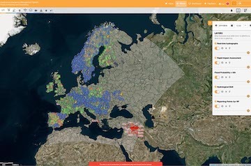
A new reporting point layer replaced the reporting points high and low layers on the EFAS web interface. The new layer provides an overview of reporting points with a flood signal expected in the next 10 days, as well as stations for which hydrological information is shared from EFAS partners. This will enable the users to see information that was previously spread over multiple layers in one single layer. The layer was put into operation with the release of EFAS v3.3 on 8 October 2019. please see full description of the layer here.
For more info on this and other EFAS releases, we refer the EFAS wiki.